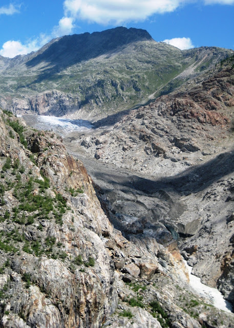
Aletsch Glacier is the largest glacier in the Alps. It has a length of about 14 mi and covers more than 46 sq mi in the eastern Bernese Alps. Its thickness is estimated to be near 1 km (3,300 ft).
From the start, taking the cable car from Mörel up to Riederalp saves 3800 feet of climbing!
An hour walk through the Aletsch Forest...

with a nice view across the valley, where you hike out of the valley later in the day...
...takes you to here, to a close up view of the Aletsch Glacier.
This 400 foot long hanging bridge hangs takes you to the other side of the valley, crossing the Massa river 250 feet below!
The end of the Aletsch Glacier from where the Massa River flows. The glacier has been receeding by 300 feet per year due to global warming.
The famous Matterhorn at the Swiss/Italy border can be seen off in the distance.
The 2.5hr hike back out of the valley, up about 1800 feet to the church on that ridge.
Looking back to the river and glacier.


Wow, another 5 star hike and perfect weather! I wish I was along for that one. It looks like 4 different regions in one hike. You should write a guide book.
ReplyDeleteOh man! How beautiful!! Just the pics left me partially breathless. Looks like a gorgeous day too! Was it not cold near the glacier and at the higher altitude for a short sleeve shirt? And did you cross that bridge? Any pictures from on the bridge? How many miles/kilometers was the hike...looks like a looong hard day! Your pictures turned out so amazing!
ReplyDeleteYo MONEY,
ReplyDeleteAbsolutely breathtaking, you cant ask for anything better than this. I would love to be there